V1.0.2 changes
Basic, Expert and Unsmoothed
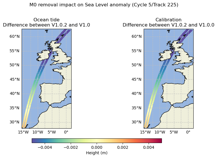
M0 wave removal
The M0 wave has been removed from the ocean tide correction FES2022 configuration. This change has a very small impact for users using the calibrated Sea Level Anomaly, because this large scale signal is absorbed by the calibration error in the V1.0.0.
The following figure illustrates the impact of removing the M0 wave over the ocean tide correction (left) and over the calibration (right). The patterns are similar, confirming the small impact over the calibrated Sea Level Anomaly.
Basic and Expert
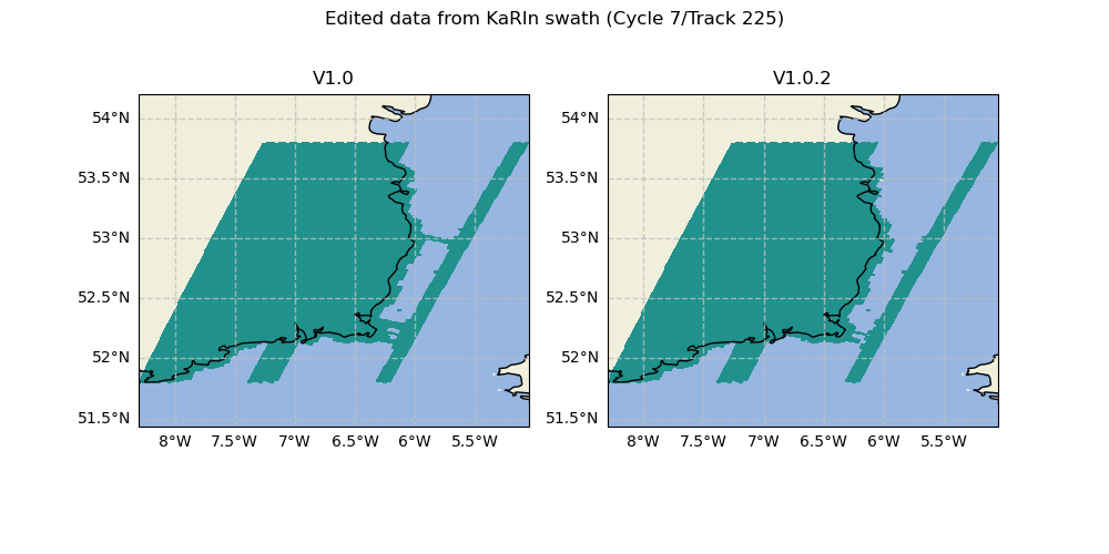
Editing near the coast
The V1.0 introduced a newer and finer land-sea mask. The editing parametrization for pixels near the coast was not properly adjusted, which can cause wrongly-edited lines in the quality flag near the coast. The new parametrization fixes this issue in the V1.0.2
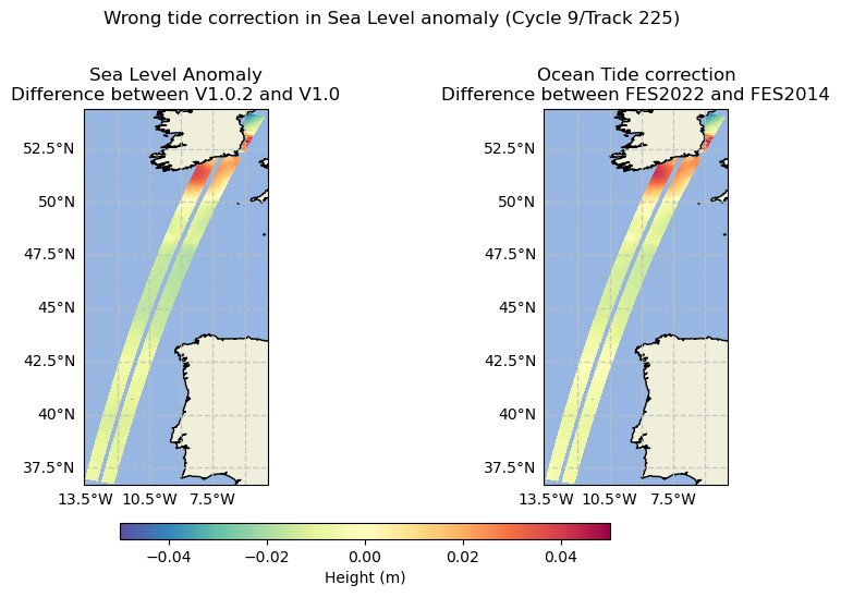
Ocean tide in Sea Level Anomaly
For products based on PIC upstream data, the ocean tide correction has been
wrongly applied. The ocean_tide field contains the expected FES2022 model, but
the sea level anomaly has been corrected using an alternative FES2014 field. The
V1.0.2 fixes the tide correction in the sea level anomaly.
Note
This issue only impacts Basic and Expert datasets starting from cycle 7
Sea state bias filling
Regions with ice have a default value for the Sea State Bias (SSB) correction.
This default value introduced a bias on the non edited Sea Level Anomaly between
the high latitudes and the rest of the ocean. This is of no consequence over the
edited ssha or filtered Sea Level Anomaly ssha_noiseless because these
regions are edited. However, this can be seen on the calibrated Sea Level
Anomaly ssha_unedited. The SSB filling method has changed to mitigate this
effect.
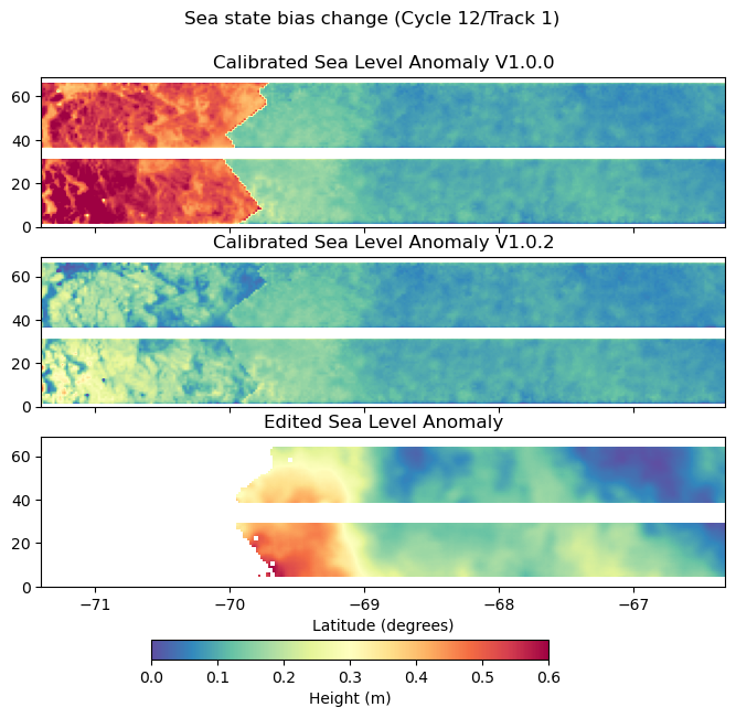
Note
This change only affects the sea state bias correction in the Basic and Expert products. The Unsmoothed product is still affected by this issue.
PIC/PGC blending
Because the PGC does not cover the most recent periods, the L3_LR_SSH upstream data is a blending of two L2_LR_SSH versions: PIC and PGC. Previously, the PGC to PIC switch was at Cycle 7 but newly available data made it possible to use PGC data up to Cycle 9.
- To summarize the upstream data versions:
PIC0 starting from Cycle 9 / Track 388
PGC0 up to Cycle 9 / Track 387 included, minus the exceptions listed in the following table
Cycle 7 |
[521-531], 533, [535-536], [538-542], [544-547] |
Cycle 9 |
[335-336], [388, 584] |
Unsmoothed
Temporal coverage
The current dataset V1.0.2 includes all data for Calval phase and data up to cycle 16 for Science phase.
Missing half orbits with respect to Expert dataset
The calibration field is interpolated from the Expert product. This interpolation needs a consistent uncalibrated sea level anomaly between the two products. A version discrepancy between the Expert and Unsmoothed product means that the sea level anomalies are not consistent.
Due to production constraints, some half orbits have different upstream versions for the Expert and Unsmoothed products. These half orbits have been removed, and will be retrieved in a future reprocessing.
Cycle 1 |
561 |
Cycle 3 |
322 |
Cycle 4 |
158, 160 |
Cycle 6 |
297, 298 |
Cycle 7 |
[532-534], 537, 543 |
Cycle 8 |
[244-245] |
Cycle 9 |
[304-331], [337-387] |
Cycle 11 |
[381-382], 384 |
Cycle 13 |
[261-262], [544-570] |
Cycle 15 |
70, 72, 74, 135, 137 |